Key Details
Distance and Elevation
Distance: 4.4 miles / 7.1km
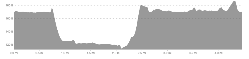
Elevation: 88ft / 27m
recommended Footwear
Road shoes are fine.
Recommended running
A great route for a recovery run with some nice views of the Campsie hills on a clear day.
local coffee fix
To my knowledge the closest are in the West End of Glasgow. Black Pine Cafe and 1841 are probably closest and both have great coffee and cakes.
Local running shop:
FKT/Segment King:
FKT/Segment Queen:
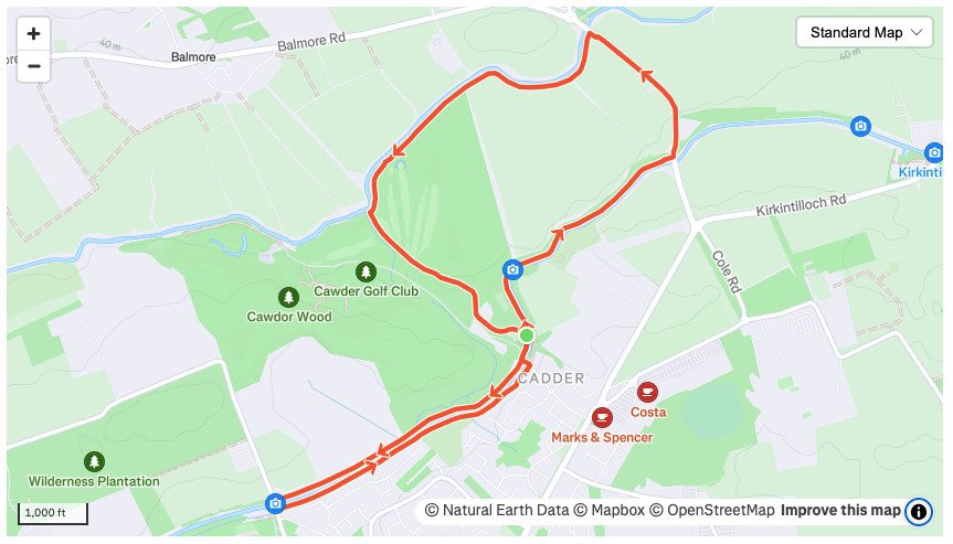
Route details
There is parking at the Cadder parish church or at the point where you leave the canal. If starting from the church run along the canal away from Glasgow and at the next bridge, leave and pick up a main road. There is a footpath to run on. Drop down the hill, heading north, until you reach the river Kelvin, where you can pick up a nice dirt trail along the river towards Cadder golf club.
Once you reach a footbridge over the river, head into the golf course and follow the path south, uphill, through the golf course. This will bring you back to where you started. From here, head in the opposite direction along the canal and at the next bridge cross over and return to the start by an off-road trail on the south side of the canal.
Similar alternatives nearby
- Canal out and back
