Key Details
Distance and Elevation
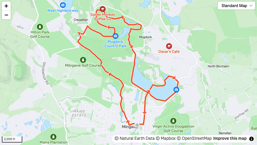
Distance: 9 miles / 14.5km
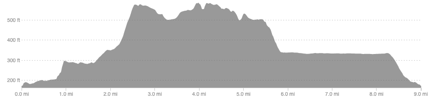
Elevation: 581ft / 177m
recommended Footwear
Road shoes or trail shoes will both do fine.
Recommended running
A nice easy run route starting on the famous West Highland Way, with a savage climb thrown in a couple of miles in.
local coffee fix
Black Pine Cafe and 1841 in the West End are the closest ones I have been to and both have great coffee and cakes. Kaf in Bearsden has been recommended but I have not tried it yet.
Local running shop:
FKT/Segment King:
FKT/Segment Queen:
Route details
Park at Milngavie train station and begin the run by heading into the high street. Pick up the West Highland Way and follow this for 2 miles along nice dirt trails. Once at the road at two miles, leave the WHW and head right. Be warned this hill is a savage one and will bite a bit, but it does get almost all of the runs climbing done in one go.
Once the road levels out pick up a track into Mugdock country park. Once in here there are many combinations you could do so don’t feel the need to follow the above route. I chose to map out a route that zig-zags and takes in as much of the park as possible. Once you are done exploring Mugdock, head out and drop down the Mugdock reservoir where there is a nice path around the perimeter. Again, feel free to add extra loops of the reservoir before dropping down back into Milngavie and back to the train station.
It is relatively east to navigate this route despite there being so many different paths you can take, which makes this a great choice if you want to include a bit of your own exploration, rather than relying purely on mine.
