Key Details
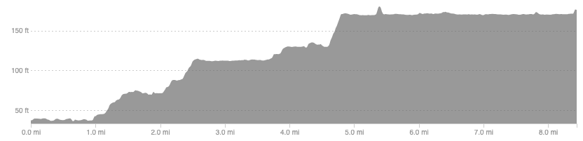
Distance and Elevation
Distance: 8.4 miles / 13.5 km
Elevation: 163ft / 50m
recommended Footwear
Road shoes.
Recommended running
Another flat and fast towpath for recovery runs and sessions. This section of the canal that runs from the firth of Clyde to the firth of Forth via Falkirk, this section within the Glasgow City Council region.
local coffee fix
Black Pine cafe is a personal favourite. Great coffee also in 1841 or Perch and Rest, with Paper Cup a brilliant option if you want more of a meal with your coffee.
Local running shop:
FKT/Segment King:
FKT/Segment Queen:
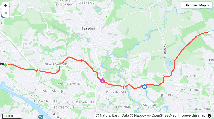
Route details
There will be many places to park along the length of this. It is an 8 mile section of the canal that spans the central belt, this part covering the Glasgow City Council region. It is 8.4 miles from one end to the other so remember you will do an out-and-back. Also, keep in mind it extends much further at either end, particularly east, so you can make it much longer.
It is great for recovery runs, tempo runs, and road session.
Similar alternatives nearby
- Kelvingrove to Canal
