Key Details
Distance and Elevation
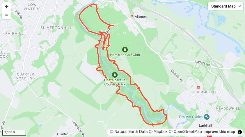
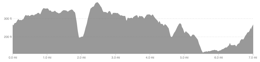
Distance: 7 miles / 11.2 km
Elevation: 706ft / 215m
recommended Footwear
Road shoes or trail shoes will do fine.
Recommended running
An undulating run on dirt trails, good for an easy run. The hills are never particularly tough but the elevation does creep up without you realising so maybe not one for the day before a session or race.
local coffee fix
I can’t recommend anywhere too close but Strathaven has a good cafe and the east end of Glasgow has plenty of options.
Local running shop:
FKT/Segment King:
FKT/Segment Queen:
Route details
There is plenty of parking in the country park so start here and follow signs for the green bridge trail. This follows a higher route around the gorge that the country park is set in. One big drop at the far end takes you down to a picturesque bridge over the river, before a gradual climb back up the other side. Follow the trail back to the start. From here you could stop at 5 miles or tag on the extra 2 miles out to the northern end of the country park, coming back alongside the river.
There is a bike path along the river Avon that would take you to Strathclyde country park if you are after a longer run.
