Key Details
Distance and Elevation
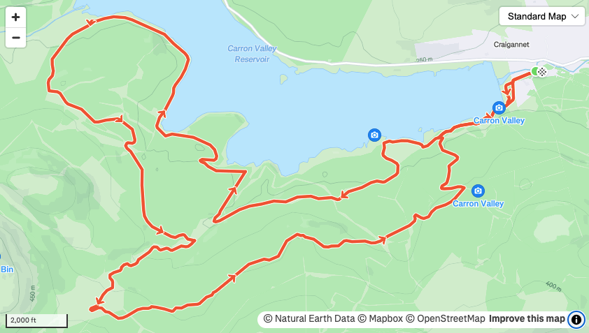
Distance: 12.2 miles / 19.6 km
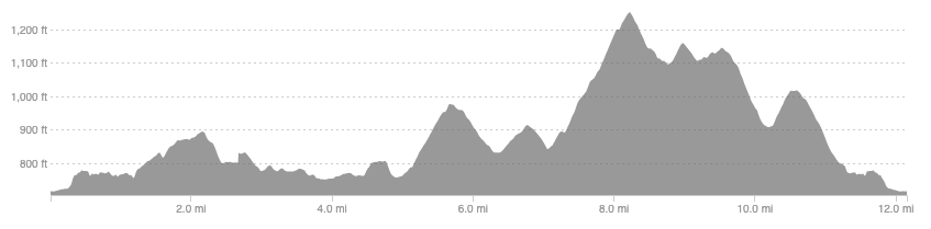
Elevation: 1304ft / 397m
recommended Footwear
Road shoes. (Trail shoes if you tag on Meikle Bin)
Recommended running
A great place to plod along and enjoy the views but you could push the pace if you felt like it.
local coffee fix
Black Pine Cafe and 1841 in the West End are the closest ones I have been to and both have great coffee and cakes. Kaf in Bearsden has been recommended but I have not tried it yet.
Local running shop:
FKT/Segment King:
FKT/Segment Queen:
Route details
This route straddles two council regions so could also be included in Stirling. There is charged parking at the eastern end of the reservoir where the route starts. Initially follow the way-marked trail that meanders along the shores of the reservoir. There are nice views and the surface is great for easy running. You follow the trail for 2.6 miles and then take a right to keep close to the water on a newer, rougher, forestry road.
This track loops around and when you leave the waterside keep heading south, don’t turn right, and you begin a long gradual climb to 7.1 miles. When leaving the water you could follow signs for Meikle Bin and tag on this summit, well seen when travelling into Glasgow along the M8 and with expansive views over the city, as an out and back. If you do not fancy the hill bagging then at 7.1 miles you have two options, low or high. Turn left and retrace your steps for the lower and flatter route. Turn right for a 1 mile climb before a long and gradual descent back to the car park. Distances are not too different and both are on forestry tracks.
