Key Details
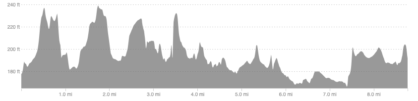
Distance and Elevation
Distance: 8.8 miles / 14.2 km
Elevation: 352ft / 107m
recommended Footwear
Road shoes or trail shoes will both be fine, perhaps trail if there has been lots of rain.
Recommended running
An easy riverside run to rejuvenate the legs and mind in Perthshire’s big tree country.
local coffee fix
Aran bakery is a popular spot in Dunkeld and rightly so, so get there fast!
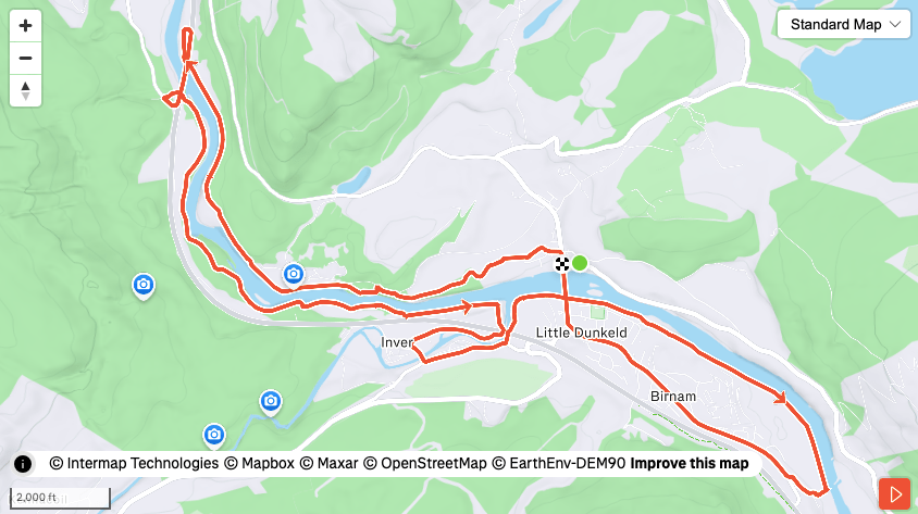
Route details
This route is relatively straightforward due to its propensity to the river Tay, almost always being a stone’s throw away from it. Starting in the main car park just over the bridge into Dunkeld, head for the main high street follow a path towards, and around the back of, the cathedral. From here the trail is obvious and easy to follow as it meanders alongside the river beneath mature broad-leaf woodland.
Around 2.5 miles in you need to leave this river side to gain the main road, crossing over the bridge and dropping back down under the bridge again to return to the waters edge, performing a kind of loop-de-loop. The trail becomes slightly more twisty and technical initially but it still runnable and is followed all the way to where the river Braan flows into the Tay. Here quickly cross at the bridge, leaving and re-entering the woods at the main road, or go under the bridge and perform a short loop of this Tay tributary, before a small loop around Birnam village.
A lovely easy run route, with an excellent selection of cafe’s and restaurants to visit after.
Similar alternatives nearby
- The Hermitage
