Key Details
Distance and Elevation
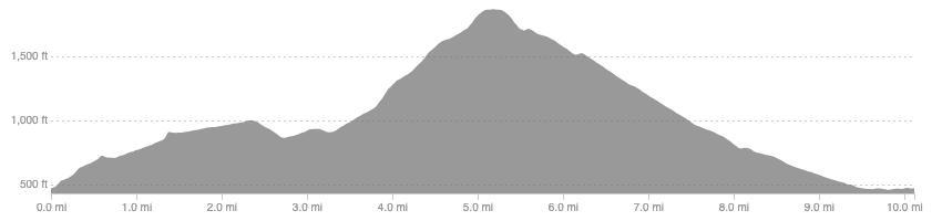
Distance: 10.1 miles / 16.3 km
Elevation: 1621ft / 494m
recommended Footwear
Road shoes are fine.
Recommended running
Easy time on feet running is best but you could push a decent pace if you wanted to make it a harder hilly run.
local coffee fix
No 1 has good coffee, cakes, and lunch. Haus and Co has great coffee and a tasty cookie, it is also a home decor shop. Both are in Innerleithen.
Local running shop:
FKT/Segment King:
FKT/Segment Queen:
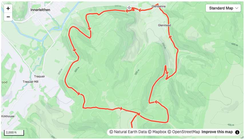
Route details
Park at the entrance to Elibank forest along the backroad between Walkerburn and Innerleithen. Begin the climb immediately on the forestry road and follow this track as it contours around the ridges overlooking Innerleithen. Stick on this same track until you reach the point where the southern upland way crosses the forestry track. Follow the SUW on a narrower trail as it climbs more steeply. This trail does not take in the summit of Minch Moor so an out-and-back detour is needed, totalling around 1km. This section can get a little boggy near the top, unsurprising given the name, but never gets too bad.
Once back at the SUW continue east until you get to another forestry road. Take this heading north and just past 7.5 miles make a U-turn to drop down to Glenbenna. From here, follow the back road back to your car.
Similar alternatives nearby
- Glenbenna horseshoe
- The Golfie
- Elibank to Glenbenna
