Key Details
Distance and Elevation
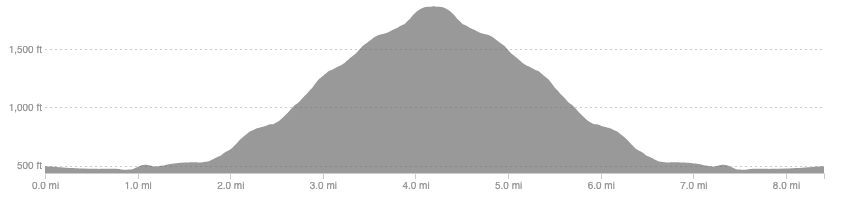
Distance: 8.4 miles / 13.5 km
Elevation: 1457ft / 444m
recommended Footwear
Road shoes are fine. You may prefer trail shoes for the climb but the first and last couple of miles are on tarmac.
Recommended running
Easy time on feet hill run.
local coffee fix
No 1 has good coffee, cakes, and lunch. Haus and Co has great coffee and a tasty cookie, it is also a home decor shop. Both are in Innerleithen.
Local running shop:
FKT/Segment King:
FKT/Segment Queen:
Route details
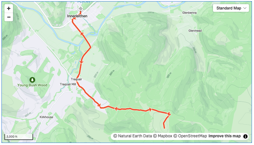
Park at one of the Innerleithen park and pedal car parks for free. At the junction by. No 1 cafe head south towards the river Tweed and cross over. At the large car park, no doubt full of mountain bikes, pick up a trail running through natural woodland towards Traquair.
Once you get to Traquair, keep an eye out for a small car park and a sign for the Southern Upland Way. From here follow this trail, also part of the ancient Cross Border Drove Road, almost all the way to the summit with a short detour for the last 500m of the climb.
To return simply retrace your steps or, if you are feeling adventurous, pick up the forestry roads and wind your way down to Walkerburn, returning to Innerleithen by the back road or the old railway line bike path.
Similar alternatives nearby
- Glenbenna horseshoe
- The Golfie
- Elibank to Glenbenna
