Key Details
Distance and Elevation
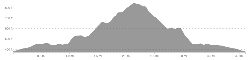
Distance: 4.1 miles / 6.6 km
Elevation: 541ft / 165m
recommended Footwear
Road shoes or trail will both be fine. May prefer trail if there has been lots of rain.
Recommended running
Easy running over an undulating loop that shows off the under-appreciated trails surrounding the heavily wooded town of Galashiels.
local coffee fix
Twelve Triangles and Haus and Co in nearby Melrose are brilliant. Galashiels also has many locally owned cafes.
Route details
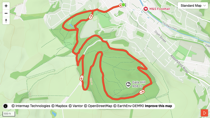
Start at the Reiver monument at the end of beautiful Bank Street in Galashiels, head south towards the new High School and the policies. There are numerous paths winding through the policies so take your pick and enjoy the woodland before finding your way to the kissing gate at the southern end of the park.
Head through the gate onto open fields and follow the worn trod to the Southern Upland Way. Climb the dyke and immediately turn left to climb a stile, which leads you up the the road between the policies and Gala hill. Head south away from town for around 200m to find a dirt track heading left past a farm house. From here, follow one of the many trails that crisscross Gala hill. The suggested route uses the best quality paths but there are so many to choose from.
Circumnavigate the leafy lump of Gala hill and make sure to enjoy the views down towards the Tweed from the northern slopes. This really shows of the splendour of the Tweed and Gala Water valleys, unusually a-forested for this traditionally farm-heavy land. One would be forgiven for thinking the residents of Tweedbank and Melrose simply bide among the trees rather than within buildings.
Once out of Gala hill one can either descend directly back to Gala, and head back to the policies to extend the loop.
Similar alternatives nearby
- Three Brethren (any option)
- Craig Contour
- The Eildons
- Leader Water and Black Hill

